What is this website?
This website shows patterns in landscape fire and its drivers, through space and time.
Who are we?
We are a team of fire researchers and research data specialists from the University of Melbourne.
Who is this website for?
This website is for anyone interested in exploring data about patterns in landscape fire and its drivers, including students and teachers, researchers, fire managers and community members. The data behind our maps and graphs is available for download.
What does the website show?
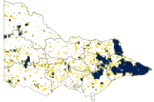
We use data from fire agencies and satellites to show where fires have happened in recent decades.
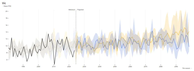
We use data from weather agencies and scientific models to show patterns in the drivers of fire over recent decades.

We use the same data combined with climate models to show potential future patterns in the drivers of fire.
All of our data is for Victoria, Australia, but the concepts are global and perhaps soon the data will be too.
We also have some other sections to explore. The Fire Concepts page describe a few ideas that are useful for thinking about fire, like the fire regime, the drivers of fire and risk. The Further Information page includes links to other information and organisations working to understand and manage fire. The Glossary defines some commonly used words.
What this site is not
- This site is not for use during a bushfire emergency. It does not contain live or up to date information. Please visit https://emergency.vic.gov.au/respond/ for incidents and warnings in Victoria.
- This site is not about taking action e.g. preventing, planning and mitigation, preparing for an upcoming fire season, forecasting, or recovering from fire.
- This site does not provide personalised or fine-scaled information (e.g. about your home, block or suburb).
- This site does not provide a comprehensive or exhaustive description of all fire-relevant data, information and knowledge.
- Links to fire-related agencies and topics can be found in Further Information
Why did we make this website?
This website aims to demonstrate some of the possibilities of communicating bushfire data and concepts clearly and engagingly. Clearly we’ve only scratched the surface and if you are interested in adapting the site or developing something yourself, we’d love to chat.
As to the bigger why, landscape is ancient, diverse, dynamic and complex. And that’s before you take into account humans and our rich histories, cultures and practices of relating to fire.
It might be quite useful if we can find ways to simplify things. This website aims to do just that, through data and concepts.
But don’t forget that beneath these simplified concepts and data lurks a lot of complexity. Talk to your friendly local scientist, fire manager or Indigenous fire knowledge holder, they’d be happy to tell you all about it.
Why do we keep calling it landscape fire?
Here in Australia, bushfire is the most common word for vegetation fires that burn across the landscape. We’re fond of the term bushfire, but there are two small problems. First, fire affects many vegetation types that aren’t obviously captured by the word bush. Secondly, fire is a global issue but most people around the world don’t use the word bushfire. Up until recently, we have been using the term wildfire because it is widely used globally. However, the word ‘wild’ carries some problematic meanings and has been used to deny the close and active relationship between First Nations people, the land and fire over many thousands of years. That leaves us with landscape fire, although maybe it would be easier just to call it fire!